Showing posts with label garúa. Show all posts

Thursday, July 28, 2016

La Garúa


My friend Nels in Lima commented about the unusually clear weather. Having been on the coastal plateau of the western slope of the Andes in winter, all I can say is, make the most of that sunshine. You may not see it again for six months. Because: La Garúa.

La garúa is a thick sea mist caused by warm tropical winds interacting with the Pacific ocean chilled by the Humboldt current. A thermal inversion. La garúa is a persistent low-level cloud cover, or fog, that blocks out the sun on the western Andes for months on end. Officially, it's winter from May to December. No matter that you're close to the equator. No sun means it's cold and damp and gray.

At sea level, la garúa drizzle evaporates, so there's no rainfall. It's an odd sensation. You can feel some dampness on your face, but if you sit on the ground, it never reaches you. Sort of like San Francisco's June Gloom on steroids. La garúa is bone-chillingly SAD—as in Seasonal Affect Disorder. A soul-smothering purgatorial greyness seemingly without end, without benefit of the delightfully earthy odor of petrichor.

The greater Atacama Desert is the driest place in the world—3 million years' worth of extreme hyperaridity. A rainshadow desert caused by the extreme height of the Andes. There is almost no rainfall along that entire thin strip of coastline that stretches the length of South America from Chile to Perú. It hasn't rained in some places in over 400 years.

The Peruvian Coastal Desert and the Sechura/Nazca Desert are northern extensions of the Atacama—by right it should be called the Sechura-Atacama desert. Bolivia lost its coastline in a Chilean-British conflict over guano during the War of the Pacific, (1879–83). Normal precipitation (in the from of fog) in the Atacama is about 0.07 inches (1.7 mm) a year.


When it does rain in the desert, the ground is so dry and hard as pavement, even an inch of rain can cause colossal flash floods. Like in 2012 and 2015. A freak snowstorm in 2011 dumped 31" of snow. I'll leave you to imagine the catastrophe that caused. (see my post Atacama Floods). Less than an inch of rain in March of 2015 (first rain in 80 years), caused not only mudflows, but an aftermath of colossal bloom of magenta flowers, the WA Post identified as desert mallow (malvia), but I suspect that might be Calandrinia, or Chilean rockrose as well.

Even the driest desert will bloom. The Atacama after a freak rain—a once-in-a-lifetime malvia bloom —Washington Post

But I digress, lost in the dizzying tracts of flowers... on the lower slopes of the western Andes, where the cloud cover kisses the mountains, a heavy fog drizzle also creates some biomes, or lomas —seasonal oases of unusual flora. A desert cloud forest.

La garúa makes Lima a damp place to be in winter. So if you've got sunny skies, pack all that sightseeing in, pronto.

What the travel guidebooks don't tell you is that la garúa makes it difficult to handwash your clothes—unless you have access to a clothes dryer. We never found any laundromats in Lima. Try drying your clothes on the clothesline during la garúa. Not gonna happen for at least six months. I melted a hair dryer trying to dry my clothes. Nae knickers and I was one cross camper.

Most people don't have washing machines, let alone clothes dryers. Some natives wear their clothes until they can stand up on their own, and just buy more when the dirty clothes run off on their own. The region is dry and dusty to boot, and aquifer water is scarce. Everybody else uses the drycleaners.

Going to the drycleaners at rush hour qualifies as a contact sport. My feet never even touched the ground as that seething mass of humanity inexorably pushed us forward to the counter to pick up our clothes. Added a whole 'nother dimension to Take me to the cleaners. I must admit I felt sheepish taking my underwear to the cleaners. But I was a much happier camper with clean knickers.

Friday, April 3, 2015

Atacama Floods


Dear CBS,

The thunderstorm wasn't the worst storm to hit Chile in seven years, it was the ONLY real rainfall to hit northern Chile in over a hundred year. You do know it's the Atacama Desert, the driest place on earth?

The last recorded rainfall was about 80 years ago. According to the Chilean deputy interior minister, Mahmud Aleuy, it's also “the worst rain disaster to fall on the north in 80 years.”

But any rain in the Atacama region is a disaster waiting to happen. When the rain falls, it has nowhere to go. No vegetation, no soil. Nothing to absorb rain. So, it's all runoff. Rain never ever falls on the Atacama. Not even on the plain.

OK, so there was a freak snowstorm in 2011. Now that was an anomaly. It was meant for the southern Andes but the high pressure marine layer was disrupted. And it snowed and snowed. No flash floods were recorded but no one knew how to drive in snow.

CBS reported that thunderstorms dumped the equivalent of 7 years' worth of rain in 12 hours. That's technically true. But how you presented the facts was a bit skewed. How much rain? Seven years' worth of rain is 24 millimeters which is 0.94488189 inches. OK, so that's almost an inch of rain (divided by seven years), not a lot of rain, but it had nowhere to go, and the desert certainly wasn't going to soak up that weird, alien stuff. Think of thick dust on on pavement. Now add water. what happens next? Flash floods.

Normal precipitation (in the from of fog) in the Atacama is about 0.07 inches (1.7 mm) a year. And the southern region's been experiencing a huge drought. But if normal is 0.07", then I guess it's been about 0.1" moisture a year in the Atacama for quite some while. 

The Atacama Desert, the driest place on Earth, has been deluged by torrential rains and floods have caused at least two deaths, swept away homes and left the region without power or infrastructure. So, yes, horrific flash floods were in order. And sadly lives and homes were lost. Seven rivers, including the Copiapo River all leapt their ancient banks, such as they were. The rivers don't get much of a workout as most of the Andes rain and snowmelt runs east to the Amazon.

What's weird about this weather is that virtually no rain ever falls this time of year. If it ever falls at all. That's the real story. The sudden autumn downpour on the heels of an unusually hot, dry summer in the throes of an eight-year drought, has left parched fields. A disaster waiting to happen.

Northern Chile is normally cloudy (la garúa), but it never rains, as the marine front blocks all showers and thunderstorms. No moisture makes it over the Andes from the east, the mountains are too tall. According to a Chilean expert, Sagliani. "It is estimated that it has not rained in some places in the Atacama Desert in hundreds, even thousands of years." The surface is so like Mars that the Mars expedition test drove its robocars in the Atacama.

I was in Lima one winter, and there was no rain there either, but la garúa, the thick fog cap, blocked the sun for weeks on end. The only precipitation along the entire South American coast from Perú to Chile, is the condensation from la garúa. Not exactly rain falling in a rainshadow.

It's so weird to walk on bone dry dirt, there is no soil. It crunches under your feet like dried clay tailings or saltine crackers. I met people in Nazca who had never seen rain in living memory. But they told stories of deluges in Biblical proportions. And there are numerous ancient flash flood scars on the desert floor to support their stories. 

Sometimes rain happens in the Atacama Desert. It may not be related to global warming.

But the drought in southern Chile is certainly related to global warming. And this storm, destined for the Maipo vineyards of southern Chile, snuck past the desert goal keepers to weep in the driest of deserts and the world's largest open copper pits. Meanwhile, Villarica, a volcano in the south, which erupted on March 3rd, is rumbling again.

Monday, November 2, 2009

Atacama Civilizations


A recent NewScientist article penned by Andy Coghlan on the downfall of ancient Peruvian civilizations is misleading, suggesting that the deforestation of kiawe (g/h/uarango, or thaccu in Quechua) or algarrobo in Spanish, aka carob trees, considered to be a keystone species of the prosopis genus, or mesquite-tree, was the reason for the downfall of ancient Nazsca civilization through the loss of a fragile desert ecosystem and precious water resources.
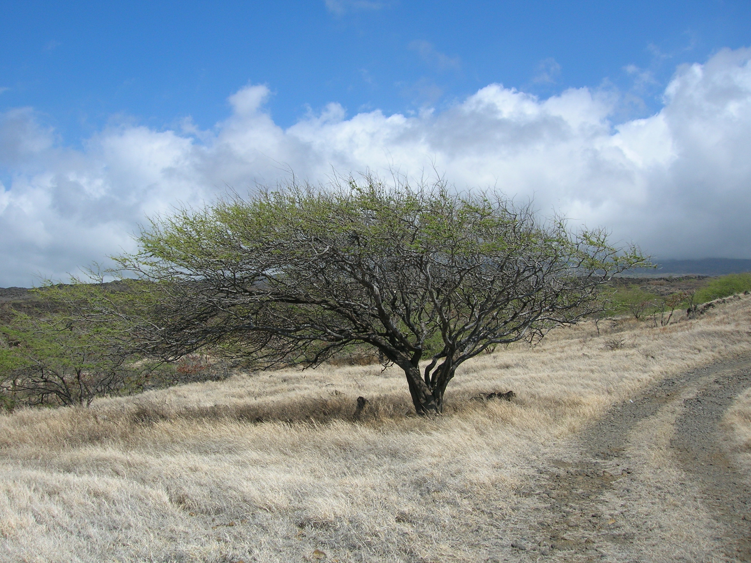
This photo is misleading as there is no grass in the Atacama

First, the Nazca (2nd c. BC - 7th c. AD) and their mysterious Nazca Lines were but one civilization inhabiting the Sechura-Atacama desert regions. Nor was the Nazca culture the only ancient Peruvian culture to create vast geoglyphs and vast irrigations systems.

Ancient civilizations rise and fall, each layer of civilization stacked upon each other like so much firewood. So the length of their stay, and their demise is part of a much larger cycle.

To enlarge the lens, there were many overlapping pre-Incan cultures that preceded, co-existed with, and followed the Nazca during 10,000 years of human settlement, including complex city-state civilizations of the northern Sechura desert region. The Chavín culture (1500 -300 BC; Late Chavin, 100-700 AD) was an Andean foothill culture but its sphere of influence was widespread along the Peruvian seaboard as far south as Nazca.

Then there were the Norte Chico/Caral-Supe cultures (3500-1800 BC), the Chimú-Moche cultures (ca.? BC -500 AD; [Moche ca. 100-800 AD]; and the late Chimú kingdom expansion into the Andean foothills of southern Perú [1370-1470 AD], their empire rivaled that of the Incas).

To the south, in the Atacama region, were the Paracas (750 to 175 BC—the oldest verified human remains date back 10,000 years), the widespread Wari (Huari) culture (500-900 AD) and the Ica-Chincha cultures (1000-1476 AD). (Paracas, in Quechua [para-ako] means raining sand—or sandstorm—the winds blow as high as 65 km/h and they will seriously sandblast you for a whole season at a time.)

The later Andean Incan Empire (1483-1583 AD) with its administratice center in Cusco, was not part of this complex—The Incan empire was the Andean equivalent to Roman empire (spanning from Columbia to Chile). So the Quechua-speaking inti-worshiping Incas are not part of this discussion.

Wikipedia Peruvian timeline:

But people are always attracted to sensationalism. And the Nazca have drawn their fair share of New Age kooks explaining both their existence and demise—from abracadabra to aliens. I fear that, under the guise of popular science, the Beresford-Jones treatise is yet another stringy theory riding the sensationalist's coat-wings.

Problem is, that the article, perhaps in the interest of brevity, does not paint an adequate representation of the larger story of the Atacama region and because of that, New(Age)Scientist readers are jumping on all the wrong bandwagons while shaking proverbial sticks and barking up all the wrong shrubs in the process....

What the NewScientist author fails to take into account of Cambridge archaeologist, Dr. David Beresford-Jones's claim, is that the vast hyper-arid Sechura-Atacama deserts, that runs along the Pacific coast from Peru to Chile, are in the most extreme rain shadow region in the entire world. And humans had absolutely nothing to do with that factor. So, naturally I was immediately questioning all assumptions.

Let me digress:

The massive Andes cordiellera blocks the path of precipitation. Rain-laden weather systems don't arrive from the Pacific, they come from the Atlantic and dump their payload on the OTHER side of the Andes. At 6895 meters (22,590 ft.) the Andes are too tall a barrier for eastern storm clouds to crest.

There are pockets high on the western slopes of the Andean foothills between 4-9,000 feet that do receive marine fog, or garúa drizzle, and sporadic rainfall spillover from the eastern storms, sometimes overflows, and is the headwater source of the few oases-rivers of Western Peru.

But the winter garúa, with its tall cloud ceiling that completely blocks out the sun for six months of the year, significantly does not come in contact with the relatively low-lying coastal region—hence no lowland drizzle is possible—despite high humidity.

Perhaps the NS author citing the fieldwork of Cambridge archaeologist David Beresford-Jones proporting the widespread deforestation theory should have looked a lot farther upstream in the timeline. Massive deforestation in the Andes is a very real problem. Deforestation of the huarango trees on the Ica plain began after Spanish colonization, with widespread massive deforestation at the beginning of the 20th century. (NB: David Beresford-Jones is very thorough in his Ph.D. thesis—it's a good read. See Ch. 8.)

The Sechura-Atacama desert NEVER get any rainfall. Ever. At least not within recorded memory. The official average is 1.5 mm per year. In some places, the average is .3 mm, or, put it this way: it hasn't rained since 1570 AD. In other places, it rains upon average—once every 400 years, the cumulative all-time average is once every century. The only place where there is any plant life at all is confined within the narrow river valley deltas, or on the crests of the isolated coastal foothill ranges of around 4-9000 feet.
The Atacama Desert in Chile (NASA)

The idea of vast tracts of forests growing along these narrow river valleys is a relative term—unless you measure the idea of forest in terms of the width and length of dry riverbeds. There are few riparian valleys—except near Pisco—which is like Needles, CA. Cutting down the huarango trees is not a logical explanation as to why the Nazca civilization suffered a catastrophic collapse around 500 AD.

The most recent major phase of enhanced precipitation in this region was about 15,000 years ago. There seems to be little evidence of massive glaciation in the Andes as well. Though current popular thought wants to mold the Atacama into a vast ancient grassland like the pampas, there's little or no evidence of it. It's been the driest desert region on earth for a lot longer (20 million years) than during the last 5000 years when the region was settled.

In the Supe River Valley, 120 miles north of Lima, the ancient city of Caral was not only the oldest city in the Americas (2600-2000 BC), contemporary with ancient Egyptian and Mesopotamian civilizations, but it also had the earliest extensive crop irrigation system. Caral geoglyphs etched on ancient flash flood plains are similar to that of the plains of Nazca. It too disappeared. As did many ancient pre-Incan Peruvian civilizations. And when it rained, entire civilizations have fallen, their mud-brick pyramid cities washed away. And I haven't even mentioned the massive earthquakes that uplift the region.
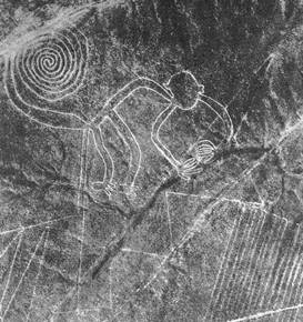
Nazca Lines or geoglyphs—the monkey.

What is the half life of the rise and fall of an ancient civilization faced with centuries of drought, catastrophic earthquakes, combined with rare torrential rains and flash floods—associated with supercharged current reversing barren El Niños—that devastated local fishing industries and rearranged coastal harbors?

The Andes mountain range is continually rising, uplifting the coastal plain—it's one of the most seismically active regions in the world—and its ceaseless uplift has rendered ancient irrigation and catchment systems obsolete in one shudder upon more than one occasion. Most of the region is situated on an alluvial mesa or tableland high above the Pacific. there are few natural harbors. Miles and miles of sheer mud cliffs drop 30 meters to the sea.

The only real form of precipitation in the Sechura-Atacama deserts is the seasonal camacacha or garúa, or thick winter (June-Sept.) marine fog. Certainly tree needles would trap some of the garua, but the fog itself never dampens the earth at lower elevations.

The Pacific Ocean is surprisingly cold, due to the Humboldt current, so the air temperature ranges from -2°C to 30°C. It's also a surprisingly fertile zone compared to the surrounding desert. There are also large colonies of penguins and fur seals thriving in one of the richest marine bio-regions of the world.

Only when there's a strong reverse warm El Niño current, does the icy nutrient-laden Humboldt current get diverted offshore and only then the traditional coastal inversion layer (anticyclone) shifts, allowing for the possibility of torrential rain and flash floods of Biblical proportions. And then there are no fish.

As far as the soil being too salty for agriculture after a flood, due to deforestation—huh? The ocean didn't climb up the enormous cliffs that rim the coast. Even a tsunami would be hard pressed to climb those cliffs. There was never excess runoff water (no rain) in the rivers to over-irrigate causing salt leaching. (Subterranean water, yes.) Dry farming and traditional drip irrigation methods were used (they tapped puquios-pipes into aquafers) to grow maize, squash, sweet potato, manioc and achira; cotton for textiles; coca, and San Pedro cactus—for religious purposes.

In the Nazca region (cradled by the Ica River and the misnamed Río Grande de Nazca), due to the sloping alluvial fan topography there were rare flash floods but no long-standing floods like New Orleans after Hurricane Katrina that took weeks to ebb. We're not talking about rich river delta floodplains here either as a large coastal range separates Nazca from the sea. But there is deep subterranean groundwater.

As for the extremely water soluble nitrate salts, the region has among the largest saltpeter deposits in the world that predate any civilizations by millions of years—suggesting an extremely stable, if, arid climate, for the lower Ica valley. Again, this points to a region of no rain.

True, the leguminous kiawe (huarango) trees desalinate soil as well as fix nitrogen (it's related to mesquite), but they would not be growing on the bone-dry arid plains but in river ravines wherever there's moisture. And they're similar to the water-hungry tamarisk, little water escapes their massive root system. So, no other plants survive in their perimeter.

Despite underground aquifers, few western Peruvian rivers actually make it all the way to the ocean. Most run dry long before they reach the Pacific like Lima's glacier-fed Rímac River.
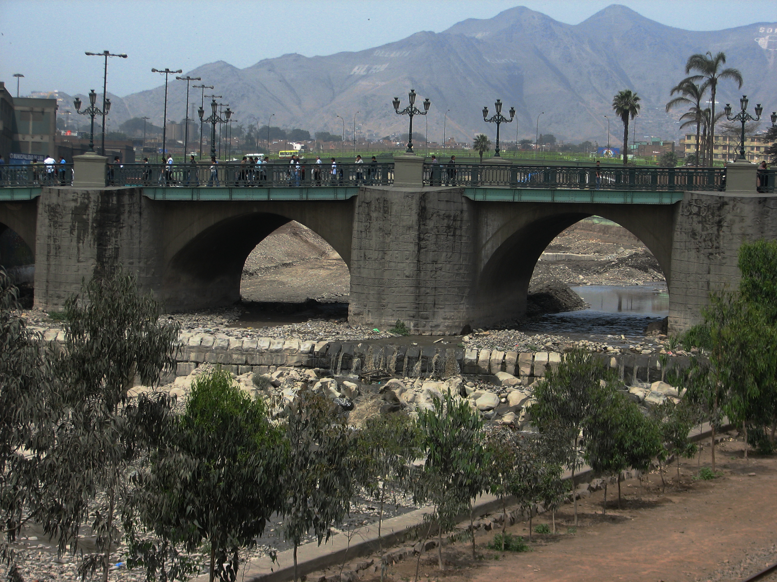
Lima's glacier-fed Rímac River is usually a dry riverbed.


Some Atacama river beds have been dry for over 120,000 years. And though there are plenty of water-rounded boulders strewing the Nazca Plain, they too are so ancient, their top surfaces are coated with a desert varnish that belie an ancient age. Desert varnish is a measurable slow-forming manganese patina, sort of like the verdigris on a copper dome. The darker the patina, the older the stone surface. The age of petroglyphs are measured in terms of desert varnish.

I picked up smooth-bellied river rocks crowned with a deep desert patina on their uppersides which means that they had lain undisturbed on the San José flood plain in that same position (the surrounding ground pebbles were also varnished) for at least 10,000 years.

Some New(Age)Scientist readers' comments also suggest a profound lack of understanding of the region. None, it seems, have ever been to the Atacama—including the author. Comments are just plain silly. There was no profound lack of imagination, no (gay) aliens, no (European) bees and certainly no livestock as we think of it— were involved. (Other than dogs, guinea pigs, alpacas and llamas—all of which were routinely harmed as they ate them.) However, according to NASA, the soil of the region is closest to that of Mars.

Blaming the farming practices of the Atacama civilizations that managed to survive with dry farming techniques for more than 5000 years—is equally silly. The armchair theorist who stated that ancient "man took a viable ecosystem and screwed it up for short term gain" is oh-so-geologically-wrong.

The idea of forest is a relative term here. One would be hard pressed to consider the mesquite that grows in Death Valley to be a forest by any stretch of the imagination—and the Mojave/Death Valley is lush (some 50 times wetter) by comparison to the Atacama.

And the Nazca civilization had plenty of faith—perhaps too much of it as they believed too heartily in their own Hereafter—judging by their practice of human sacrifice. It's a miracle they survived at all in such an extreme region.

There is, however, ample archaeological evidence that head-hunting became a major preoccupation during the middle and late Nazca culture. Maybe they just ran out of heads to trepan or they were victims of too much intense cranial manipulation—sort of like this article.

Maybe Beresford-Jones is right that the destruction of the huarango forest contributed to the downfall of the Nazca civilization, maybe my argument is slant-rhyme, maybe I'm too old school to accept these currently popular theories. Or I'm just cranky. But to my way of thinking, 4700 to 1500 years for any ancient civilization to survive under such harsh conditions seems to be a pretty good track record.


Note Bene: (In this case, it's a post mortem): A little internet sleuthing uncovered Beresford-Jones' 2004 PhD thesis on the same subject matter. So, was he out to prove his thesis correct? I haven't read it all yet, but Beresford-Jones compares the Nazca of the Samaca basin to the Sonoran culture as a model. OK, right there, that gets my goat.

The Sonoran desert is considered the lushest and wettest of the world's deserts, more rain (10-12 inches) falls in the Sonoran desert than any other desert. Though many of the same plants grow in both regions, the extra moisture of the Sonoran desert needs to be taken into consideration as well.

A closer comparison might have been the Mojave desert which receives less than 10 inches of rain (250 mm) per year, or better yet, Death Valley. The the annual rainfall average of Death Valley, the hottest, driest place in North America, is 1.5-1.9 inches (38-49 mm), comparable to the wetter regions of the Atacama.

Point being that these desert regions receive at least 50 times the amount of moisture as the Atacama (1.5 mm per year), so I remain skeptical.

The indigenous Sonoran cultures are varied: Pima-O'odham, Gila River, Papago, Pascua Yaqui (Yoeme), Seri, Tohono, Guarijio, Cavapizca, Tuguarda, and the Cocopah, to name a few.

I noted that Beresford-Jones also seems to refer to the Nazca culture as a unique singularity but all the Sechura-Atacama region civilizations practiced some form of massive geoglyphics—as well as constructing complex irrigation systems—not to mention temples and pyramid complexes.

Then there's the danger of making a hypothesis (say, a Ph.D. thesis) and then going out to find supporting evidence it because you're looking for material to that will fit your theory.

Me, I'll take the Schrodinger's cat approach. Is you in or is you out?

THESIS: OK, in the introduction, Beresford-Jones refers to the possibility of massive ancient deforestation. Right there, my dander's up—I think he's wrong. No indication of massive anything in Nazca, except mud and geoglyphs. Hundreds of mesquite tree trunks does not a forest make. Deforestation is a very real new-colonial manifestation beginning in the 16th c., and escalating during the Industrial Revolution.

However, Beresford-Jones' thesis does thoroughly assuage my concerns about the weather in more technical terms than I have access to. Too bad that information was omitted from the NewScientist article…it would have gone far to put my 'yeah-buts" at ease. It's a LOOOONG Ph.D. I may not get through it all…I'm up to Chapter 9.

Here's a thought: how does one critically read a piece? The wired story obviously got my dander up, due to obvious holes in the weather theory, but the Ph.D. thesis, less so—however I'm barely into it so I don't have the actual data in hand, er in my brain. Question is, do I really want to invest this kind of time to prove/disprove someone's theory? Other than the fact that I've been there, or that I harbor some opinions, what's in it for me?

Though I have an abiding interest in archaeology, I am not an archaeologist. That critical reading thing: I emotionally responded to the so-called facts presented, because my gut said they were wrong. I began to write this in order to see what I needed to know/relearn. So for me it's a teaching tool—a reason to learn.

However, when I began to research this piece, I found plenty of evidence to prove my climatic theory right—but the premise that the tree pollen count dropped (indicating the fall of the Nazca empire) requires further investigation. Sleuth on.

Disclamer: most links are from Wikipedia, there to expand the knowledge base but I read all Wiki articles with a grain of salt as they are not scholarly articles. That said, the links I've included seem accurate enough to shed light.


Sunday, August 21, 1988

Letter to Luis Kong, from the Necropolis, Paracas, poem


LETTER TO LUIS KONG FROM THE NECROPOLIS, PARACAS 8/21/88
(RETURNING FROM PARACAS)

In Paracas where it has never rained in living memory, literally nothing grows. You told me there was nothing here in this place of your birth. I didn't understand what you meant. This place I've waited a lifetime to visit.

The garúa or coastal fog, rolls back each morning to reveal distant purple mountains, the Andean foothills, contrasting with the eroded bright ochre and red coastline of sedimentary rock turning back into dust once again.

Dust with its airiness is the wrong word to use. I want to say mud or earth to imply something of the weight and adhesion of this "dust." What is left is heavier than dust.

From countless jailed lips, the word Paracas has escaped—an eager storm of Inca doves bursting into sky, or slender serpentine syllables seeking shelter, and like pigeons, the sound returns home to its toothy origin only to find the speaker gone; a skeletal utterance, the word itself meaning dust storm.

Heavy with silica, the drifting sand dunes march in crescent-hooved formation over hills and plateaus, swallowing cities of the living and the dead. Above the buried necropolis, fossilized shells raised above the surface of the matrix, escape from stone prisons.

Sun, wind and time erodes this place. Fragments of quartz, venial intrusion once separated two layers of mudrock; thick milk glass shards strewn across the surface; the parent rock long since scattered by the four winds.

I crumble silica crystals between my fingers as if it were made of sugar or fake windows of a Hollywood stage set. Lit by morning sun, translucent alabaster "fish" swim in the sky.

Strange, unbroken ridges fall at the angle of declination to the coastal plateau. Rusted metamorphic pebbles erratically eroded by alluvial action, not water, glaze the slopes like chocolate "fleas" on a cake.

I wander between large shell mounds, each separated by species, clams, purple scallops and snails; worn pawns in a gigantic game of chess. The Paracas Indians were the first to fall to the Incas, who in turn, fell to the Spaniards. And so on. From flamingo carcasses, crazy pink feathers tumble across the desert.

Wednesday, July 13, 1988

Post Office Bay, Floriana Island, Galápagos Journal


At Post Office Bay, Floriana Island, I collect postcards from strangers addressed to my home town, Lagunitas, and more cards to Tiburon, and Bolinas—to hand-deliver. It is the custom.

One card from an unknown traveler, is addressed to my old biology teacher Al Molina, from the temporary address of 0° latitude. Degrees of separation.

I retrieve mail from an old biology teacher who entrusted a messenger with the postcard, like a baton in a slow race played by ships traveling from one port to port, on airplanes, and by way of the gringo trail, spreading the word.

Some 200 years later, we reenact the whalers' mail system on this barren island in the middle of the Pacific. The garúa,  the winter mist blurs the definition of sea and sky, time and space.

I sent a postcard to my friend. I write on it, the person who delivers this will marry you…

7/13/1988


Tuesday, July 12, 1988

In a small boat, adrift, between Islands, Galápagos Journal


Leaving Puerto Ayora in a small boat

Yesterday we saw soaring albatrosses and frigate birds, and fairy-like silver-winged flying fish accompanied the our. I rode the bow of the vessel, more panga, than boat, straddling it like a horse, the chattering dolphins brushed my feet as they surfed the crest of the bow wave.

Suddenly we stopped short, the boat stalled in open water. A rope from a Japanese fishing boat used to catch sharks, had wrapped itself around the propeller. We were adrift in this frigid, Antarctic current. Too many people in an open boat. Too far from shore to even see a horizon, other than water.

There is nothing between us and the invisible equator, there was nothing but water between us and the equator. Nothing but frigid water between us and Antarctica. We were adrift in a small boat between islands. The ocean, a vast bell curve.

How large, the sea, and the connections between two things: a marriage and consummation of rope and propeller. The first mate diving beneath the boat again and again to cut the rope free. I hold onto the rope of the panga, tossing like a small horse and these deeper than blue waters.

The sea rises and troughs valleys and mountains shifting like the aging confidence in the motion faster than the eye can see. These undulations and escarpments.

I think of my high school classmate Jeff Aloha, adrift at sea in that sailboat, The Spirit, waiting for death. Is this how the sea seemed to him, adrift 43 days without water, and five companions, one or two who lived to tell the tale, but not Jeff with those beautiful blue eyes, those Finnish Viking eyes.

And on our boat, The Ancucho, French orthinologist Michel's eyes were startling glaciers, I thought the sea would rob us for that color blue. The jealous sky is bringing in the garúa, the ever-present mist, it surrounds us. And thickens. Not a good thing if we can’t fix the boat. 

We take turns getting seasick, barfing off the other side. As the diver frees the propeller from bondage, we all cheer. One piece of rope firmly wrapped around the propeller, stays, it is a reminder of what could have happened. Tourists adrift in a small open boat. We place all our faith in our Ecuadorian diver.

The boat makes its way to Española Island, about two-and-a-half hours away, we are overloaded with a cargo of gasoline, vapor settles in the cabin. If not death by water, perhaps then, by fire? This whole trip was a mad lark because we couldn’t get on a designated tourist tour boat, so we put our own tour together cobbled with enthusiasm and remorse.

These volcanoes beneath the Nazca plate, the ever present hunger from the belly of the earth. We are only so much bait for the sharks after all. The dolphins that ride air and bow are gone, like the albatross.

There is so much to record, and so little time. As I write this, I look out to sea to keep from getting ill. I write without looking at the pages.


The hieroglyphic fish with what looks like Japanese writing on their sides, have no translation for this. We impose our desire for patterns, desire for order upon this revolution of events and call it a plan. A grand scheme in this need for a god.

Random elements of the universe converge upon us as we carve and withhold the patterns to fit in like the Southern Cross or the Big Dipper, or on the equator you can see both. Polaris is below the horizon. Only by stars or compass, ferrous oxide enlightenment, can we get our bearings?

Shadows fall like clothes about our feet and we stumble along naked at last waiting for the seed to swallow us in dreams, for what is real? The time we spend earning money, too exhausted to go to to some exotic places on the gringo trail?

I was going to say, on the road like Kerouac but he didn't come this far south. We are well out of native waters tracing back the origin of order in the Galápagos, checking out the feasibility of diversification. We have a list to check off endemic species, ourselves, transient as the fish.

We come in big silver planes and then complain about our meals: arroz con pollo day in and day out, while the street children starve. Minute variations of the sea and the sameness of sea, the pale turquoise water.

Every once in a while one can feel the engine miss, our confidence is only skin deep. Like the colors of our skin on this boat, we are well represented nations ride with divergent speciation and adaptability of gene pool. Should we land on a deserted island to begin anew?

I am reminded of a story where a disease struck, nearly everyone died—Earth Abides. A new society formed. The brightest of children of this new society did not survive, only the most able.

The accidental mixture of people on this boat, the brightest of us all going to sea in a small boat, like the owl and the pussycat, who is most able? A strange marriage of sea and sky, the gray on the bell curve of sea and sky is like a toy rope and the shadow of meniscus and if the boat goes down, this  writing will melt off the page, and words will float out to sea to recombine into a new story.

7/12/1988
added 10/16

Sunday, July 3, 1988

LA MITAD DEL MUNDO

LA MITAD DEL MUNDO

Today I straddled the equator,
I stood in the middle of the world,
where I balanced with a foot
planted in each hemisphere,
where north and south become one,
where there is no separation of seasons,
where my bilateral body was equidistant,
where days and nights are equal,
where the garúa, the jealous drizzle
hid the volcanoes from our sight,
where we were enveloped
in a perpetual fog of misery,
Neptune's kingdom below us,
the sun's fiery eye, watching us
on any given Sunday.

7/3/1988
added, revised 10/12/2016