A recent
NewScientist article penned by Andy Coghlan on the downfall of ancient Peruvian civilizations is misleading, suggesting that the deforestation of
kiawe (g/
h/uarango, or
thaccu in Quechua) or
algarrobo in Spanish, aka
carob trees, considered to be a keystone species of the
prosopis genus, or
mesquite-tree, was the reason for the downfall of ancient Nazsca civilization through the loss of a fragile desert ecosystem and precious water resources.
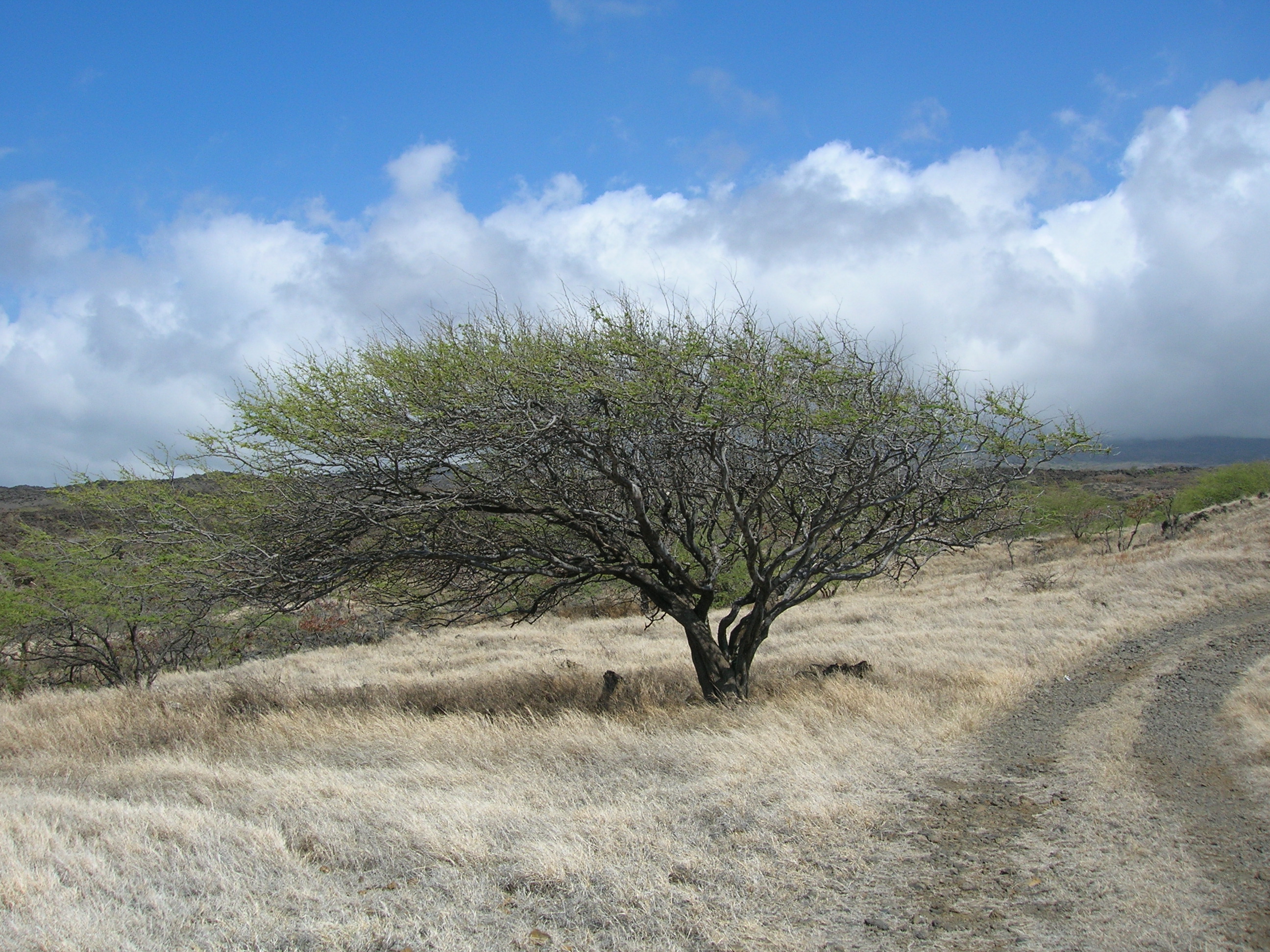 |
| This photo is misleading as there is no grass in the Atacama |
First, the
Nazca (2nd c. BC - 7th c. AD) and their mysterious Nazca Lines were but one
civilization inhabiting the
Sechura-
Atacama desert regions. Nor was the
Nazca culture the only ancient Peruvian culture to create vast geoglyphs and vast irrigations systems.
Ancient civilizations rise and fall, each layer of civilization stacked upon each other like so much firewood. So the length of their stay, and their demise is part of a much larger cycle.
To enlarge the lens, there were many overlapping pre-Incan cultures that preceded, co-existed with, and followed the Nazca during 10,000 years of human settlement, including complex city-state civilizations of the northern Sechura desert region. The
Chavín culture (1500 -300 BC; Late Chavin, 100-700 AD) was an Andean foothill culture but its sphere of influence was widespread along the Peruvian seaboard as far south as Nazca.
Then there were the
Norte Chico/Caral-Supe cultures (3500-1800 BC), the
Chimú-
Moche cultures (ca.? BC -500 AD; [Moche ca. 100-800 AD]; and the late Chimú kingdom expansion into the Andean foothills of southern Perú [1370-1470 AD], their empire rivaled that of the Incas).
To the south, in the Atacama region, were the
Paracas (750 to 175 BC—the oldest verified human remains date back 10,000 years), the widespread
Wari (Huari) culture (500-900 AD) and the
Ica-
Chincha cultures (1000-1476 AD). (Paracas, in Quechua [
para-ako] means raining sand—or sandstorm—the winds blow as high as 65 km/h and they will seriously sandblast you for a whole season at a time.)
The later Andean
Incan Empire (1483-1583 AD) with its administratice center in Cusco, was not part of this complex—The Incan empire was the Andean equivalent to Roman empire (spanning from Columbia to Chile). So the
Quechua-speaking
inti-worshiping Incas are not part of this discussion.
But people are always attracted to sensationalism. And the Nazca have drawn their fair share of New Age kooks explaining both their existence and demise—from abracadabra to aliens. I fear that, under the guise of popular science, the Beresford-Jones treatise is yet another stringy theory riding the sensationalist's coat-wings.
Problem is, that the article, perhaps in the interest of brevity, does not paint an adequate representation of the larger story of the Atacama region and because of that, New(Age)Scientist readers are jumping on all the wrong bandwagons while shaking proverbial sticks and barking up all the wrong shrubs in the process....
What the NewScientist author fails to take into account of Cambridge archaeologist, Dr. David Beresford-Jones's claim, is that the vast hyper-arid Sechura-Atacama deserts, that runs along the Pacific coast from Peru to Chile, are in the most extreme rain shadow region in the entire world. And humans had absolutely nothing to do with that factor. So, naturally I was immediately questioning all assumptions.
Let me digress:
The massive Andes cordiellera blocks the path of precipitation. Rain-laden weather systems don't arrive from the Pacific, they come from the Atlantic and dump their payload on the OTHER side of the Andes. At 6895 meters (22,590 ft.) the Andes are too tall a barrier for eastern storm clouds to crest.
There are pockets high on the western slopes of the Andean foothills between 4-9,000 feet that do receive marine fog, or garúa drizzle, and sporadic rainfall spillover from the eastern storms, sometimes overflows, and is the headwater source of the few oases-rivers of Western Peru.
But the winter
garúa, with its tall cloud ceiling that completely blocks out the sun for six months of the year, significantly does not come in contact with the relatively low-lying coastal region—hence no lowland drizzle is possible—despite high humidity.
Perhaps the NS author citing the fieldwork of Cambridge archaeologist David Beresford-Jones proporting the widespread deforestation theory should have looked a lot farther upstream in the timeline. Massive deforestation in the Andes is a very real problem. Deforestation of the huarango trees on the Ica plain began after Spanish colonization, with widespread massive deforestation at the beginning of the 20th century. (NB: David Beresford-Jones is very thorough in his Ph.D. thesis—it's a good read. See Ch. 8.)
The Sechura-Atacama desert NEVER get any rainfall. Ever. At least not within recorded memory. The official average is 1.5 mm per year. In some places, the average is .3 mm, or, put it this way: it hasn't rained since 1570 AD. In other places, it rains upon average—once every 400 years, the cumulative all-time average is once every century. The only place where there is any plant life at all is confined within the narrow river valley deltas, or on the crests of the isolated coastal foothill ranges of around 4-9000 feet.
 |
| The Atacama Desert in Chile (NASA) |
The idea of vast tracts of forests growing along these narrow river valleys is a relative term—unless you measure the idea of forest in terms of the width and length of dry riverbeds. There are few riparian valleys—except near Pisco—which is like Needles, CA. Cutting down the huarango trees is not a logical explanation as to why the Nazca civilization suffered a catastrophic collapse around 500 AD.
The most recent major phase of enhanced precipitation in this region was about 15,000 years ago. There seems to be little evidence of massive glaciation in the Andes as well. Though current popular thought wants to mold the Atacama into a vast ancient grassland like the pampas, there's little or no evidence of it. It's been the driest desert region on earth for a lot longer (20 million years) than during the last 5000 years when the region was settled.
In the Supe River Valley, 120 miles north of Lima, the ancient city of
Caral was not only the oldest city in the Americas (2600-2000 BC), contemporary with ancient Egyptian and Mesopotamian civilizations, but it also had the earliest extensive crop irrigation system.
Caral geoglyphs etched on ancient flash flood plains are similar to that of the plains of Nazca. It too disappeared. As did many ancient pre-Incan Peruvian civilizations. And when it rained, entire civilizations have fallen, their mud-brick pyramid cities washed away. And I haven't even mentioned the massive earthquakes that uplift the region.
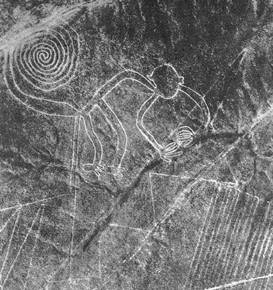 |
| Nazca Lines or geoglyphs—the monkey. |
What is the half life of the rise and fall of an ancient civilization faced with centuries of drought, catastrophic earthquakes, combined with rare torrential rains and flash floods—associated with supercharged current reversing barren El Niños—that devastated local fishing industries and rearranged coastal harbors?
The Andes mountain range is continually rising, uplifting the coastal plain—it's one of the most seismically active regions in the world—and its ceaseless uplift has rendered ancient irrigation and catchment systems obsolete in one shudder upon more than one occasion. Most of the region is situated on an alluvial mesa or tableland high above the Pacific. there are few natural harbors. Miles and miles of sheer mud cliffs drop 30 meters to the sea.
The only real form of precipitation in the Sechura-Atacama deserts is the seasonal camacacha or garúa, or thick winter (June-Sept.) marine fog. Certainly tree needles would trap some of the garua, but the fog itself never dampens the earth at lower elevations.
The Pacific Ocean is surprisingly cold, due to the Humboldt current, so the air temperature ranges from -2°C to 30°C. It's also a surprisingly fertile zone compared to the surrounding desert. There are also large colonies of penguins and fur seals thriving in one of the richest marine bio-regions of the world.
Only when there's a strong reverse warm El Niño current, does the icy nutrient-laden Humboldt current get diverted offshore and only then the traditional coastal inversion layer (anticyclone) shifts, allowing for the possibility of torrential rain and flash floods of Biblical proportions. And then there are no fish.
As far as the soil being too salty for agriculture after a flood, due to deforestation—huh? The ocean didn't climb up the enormous cliffs that rim the coast. Even a tsunami would be hard pressed to climb those cliffs. There was never excess runoff water (no rain) in the rivers to over-irrigate causing salt leaching. (Subterranean water, yes.) Dry farming and traditional drip irrigation methods were used (they tapped puquios-pipes into aquafers) to grow maize, squash, sweet potato, manioc and achira; cotton for textiles; coca, and San Pedro cactus—for religious purposes.
In the Nazca region (cradled by the Ica River and the misnamed Río Grande de Nazca), due to the sloping alluvial fan topography there were rare flash floods but no long-standing floods like New Orleans after Hurricane Katrina that took weeks to ebb. We're not talking about rich river delta floodplains here either as a large coastal range separates Nazca from the sea. But there is deep subterranean groundwater.
As for the extremely water soluble nitrate salts, the region has among the largest saltpeter deposits in the world that predate any civilizations by millions of years—suggesting an extremely stable, if, arid climate, for the lower Ica valley. Again, this points to a region of no rain.
True, the leguminous kiawe (huarango) trees desalinate soil as well as fix nitrogen (it's related to mesquite), but they would not be growing on the bone-dry arid plains but in river ravines wherever there's moisture. And they're similar to the water-hungry tamarisk, little water escapes their massive root system. So, no other plants survive in their perimeter.
Despite underground aquifers, few western Peruvian rivers actually make it all the way to the ocean. Most run dry long before they reach the Pacific like Lima's glacier-fed
Rímac River.
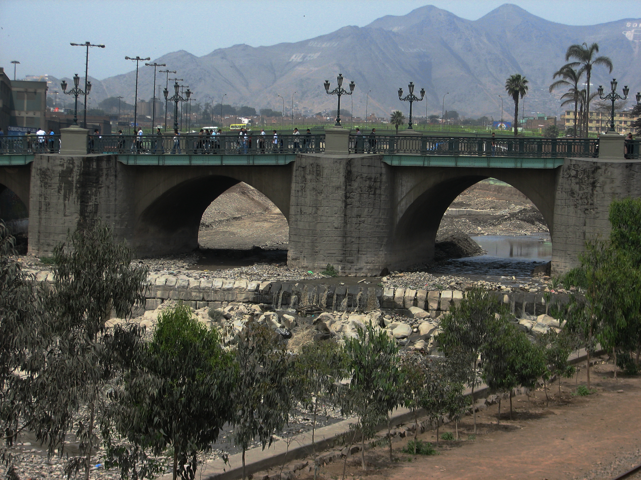 |
| Lima's glacier-fed Rímac River is usually a dry riverbed. |
Some Atacama river beds have been dry for over 120,000 years. And though there are plenty of water-rounded boulders strewing the Nazca Plain, they too are so ancient, their top surfaces are coated with a desert varnish that belie an ancient age. Desert varnish is a measurable slow-forming manganese patina, sort of like the verdigris on a copper dome. The darker the patina, the older the stone surface. The age of petroglyphs are measured in terms of desert varnish.
I picked up smooth-bellied river rocks crowned with a deep desert patina on their uppersides which means that they had lain undisturbed on the San José flood plain in that same position (the surrounding ground pebbles were also varnished) for at least 10,000 years.
Some New(Age)Scientist readers' comments also suggest a profound lack of understanding of the region. None, it seems, have ever been to the Atacama—including the author. Comments are just plain silly. There was no profound lack of imagination, no (gay) aliens, no (European) bees and certainly no livestock as we think of it— were involved. (Other than dogs, guinea pigs, alpacas and llamas—all of which were routinely harmed as they ate them.) However, according to NASA, the soil of the region is closest to that of Mars.
Blaming the farming practices of the Atacama civilizations that managed to survive with dry farming techniques for more than 5000 years—is equally silly. The armchair theorist who stated that ancient "man took a viable ecosystem and screwed it up for short term gain" is oh-so-geologically-wrong.
The idea of forest is a relative term here. One would be hard pressed to consider the mesquite that grows in Death Valley to be a forest by any stretch of the imagination—and the Mojave/Death Valley is lush (some 50 times wetter) by comparison to the Atacama.
And the Nazca civilization had plenty of faith—perhaps too much of it as they believed too heartily in their own Hereafter—judging by their practice of human sacrifice. It's a miracle they survived at all in such an extreme region.
There is, however, ample archaeological evidence that head-hunting became a major preoccupation during the middle and late
Nazca culture. Maybe they just ran out of heads to trepan or they were victims of too much intense cranial manipulation—sort of like this article.
Maybe Beresford-Jones is right that the destruction of the huarango forest contributed to the downfall of the Nazca civilization, maybe my argument is slant-rhyme, maybe I'm too old school to accept these currently popular theories. Or I'm just cranky. But to my way of thinking, 4700 to 1500 years for any ancient civilization to survive under such harsh conditions seems to be a pretty good track record.
Note Bene: (In this case, it's a post mortem): A little internet sleuthing uncovered Beresford-Jones' 2004 PhD thesis on the same subject matter. So, was he out to prove his thesis correct? I haven't read it all yet, but Beresford-Jones compares the Nazca of the Samaca basin to the Sonoran culture as a model. OK, right there, that gets my goat.
The
Sonoran desert is considered the lushest and wettest of the world's deserts, more rain (10-12 inches) falls in the
Sonoran desert than any other desert. Though many of the same plants grow in both regions, the extra moisture of the Sonoran desert needs to be taken into consideration as well.
A closer comparison might have been the
Mojave desert which receives less than 10 inches of rain (250 mm) per year, or better yet, Death Valley. The the annual rainfall average of
Death Valley, the hottest, driest place in North America, is 1.5-1.9 inches (38-49 mm), comparable to the wetter regions of the Atacama.
Point being that these desert regions receive at least 50 times the amount of moisture as the Atacama (1.5 mm per year), so I remain skeptical.
The indigenous
Sonoran cultures are varied: Pima-O'odham, Gila River, Papago, Pascua Yaqui (Yoeme), Seri, Tohono, Guarijio, Cavapizca, Tuguarda, and the Cocopah, to name a few.
I noted that Beresford-Jones also seems to refer to the Nazca culture as a unique singularity but all the Sechura-Atacama region civilizations practiced some form of massive geoglyphics—as well as constructing complex irrigation systems—not to mention temples and pyramid complexes.
Then there's the danger of making a hypothesis (say, a Ph.D. thesis) and then going out to find supporting evidence it because you're looking for material to that will fit your theory.
Me, I'll take the Schrodinger's cat approach. Is you in or is you out?
THESIS: OK, in the introduction, Beresford-Jones refers to the possibility of massive ancient deforestation. Right there, my dander's up—I think he's wrong. No indication of massive anything in Nazca, except mud and geoglyphs. Hundreds of mesquite tree trunks does not a forest make. Deforestation is a very real new-colonial manifestation beginning in the 16th c., and escalating during the Industrial Revolution.
However, Beresford-Jones' thesis does thoroughly assuage my concerns about the weather in more technical terms than I have access to. Too bad that information was omitted from the NewScientist article…it would have gone far to put my 'yeah-buts" at ease. It's a LOOOONG Ph.D. I may not get through it all…I'm up to Chapter 9.
Here's a thought: how does one critically read a piece? The wired story obviously got my dander up, due to obvious holes in the weather theory, but the Ph.D. thesis, less so—however I'm barely into it so I don't have the actual data in hand, er in my brain. Question is, do I really want to invest this kind of time to prove/disprove someone's theory? Other than the fact that I've been there, or that I harbor some opinions, what's in it for me?
Though I have an abiding interest in archaeology, I am not an archaeologist. That critical reading thing: I emotionally responded to the so-called facts presented, because my gut said they were wrong. I began to write this in order to see what I needed to know/relearn. So for me it's a teaching tool—a reason to learn.
However, when I began to research this piece, I found plenty of evidence to prove my climatic theory right—but the premise that the tree pollen count dropped (indicating the fall of the Nazca empire) requires further investigation. Sleuth on.
Disclamer: most links are from Wikipedia, there to expand the knowledge base but I read all Wiki articles with a grain of salt as they are not scholarly articles. That said, the links I've included seem accurate enough to shed light.


